


GeoFieldBook app for iPhone and iPad
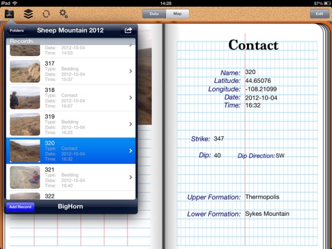
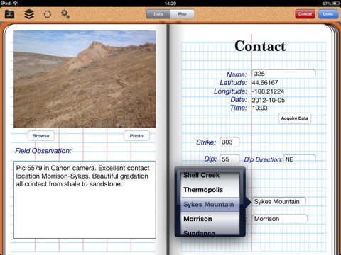
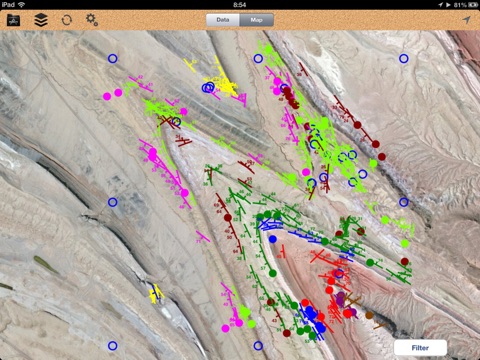
GeoFieldBook is designed for use in structural geology field mapping projects as a complement or replacement for the traditional paper field notebook and maps. The App integrates the iPads GPS, camera, data management and mapping capabilities to allow geologists to record structural and formation information, automatically log geo-located data, link images to each record and input pre-defined formation names for different mapping areas. The records are then displayed in real-time on an image base (Apple) with strikes and dips displayed in the correct orientation and color-coded to the formation list. Field measurements and notes can be exported in csv format for integration into analysis software. Existing data sets (records and formation lists) can also be imported into the App.
Record types currently supported (more are coming):
- Bedding
- Contacts
- Faults
- Joints
- Other (generic entries)
- Up to five additional user-defined record types with five additional fields per record.
Depending upon the record type selected, inputs include:
- Name (your entry)
- Location (auto recorded)
- Time/date (auto recorded)
- Dip amount and direction (from your measurements)
- Formations (scroll wheel entry)
- Notes (your entry)
- Five additional user-defined input fields